The Biblical Flood That ‘Began’ History! Meltwater Pulse 1A
Get link
Facebook
X
Pinterest
Email
Other Apps
How ‘history’ disregards Earth’s cataclysms and its affect on past, present, and future humans.
By Gianangelo Dichio
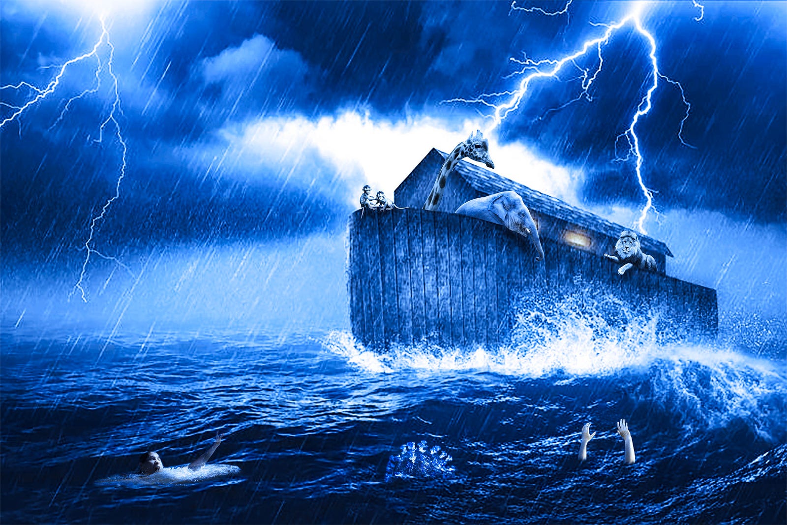
Imagine a flood 1000 feet tall and flowing at 100 miles per hour! This was one of the Missoula floods that ended the last ice age 14,600 years ago during what was called Meltwater Pulse 1A(MWP 1A).
Note: A meltwater pulse is an increase of glacial meltwater entering the oceans during deglaciation. Also kya stands for thousand years ago (read on).
In the 500 years after MWP 1A, sea levels rose by an estimated 18 meters , sending the Earth into the last stage of the Pleistocene (1.8 million ya -1.7 kya), the Younger Dryas (12.9-11.7 kya), and eventually into the Holocene (11.7 kya — present), the interglacial period that we currently live in.
The Younger Dryas was the period of time after the 10–15ºC increase in temperature that caused MWP 1A when the temperature plummeted 10–20ºC sending the Earth back down to glacial temperatures until the end of the Younger Dryas when, once again, temperatures rapidly increased by 10–15ºC leading into the Holocene. This caused the supposed Meltwater Pulse 1B, a more debatable Meltwater Pulse than 1A that is important to note in this article, but a behemoth of a topic in itself. For now we will stick to MWP 1A, Younger Dryas, and Earthly Cataclysms!
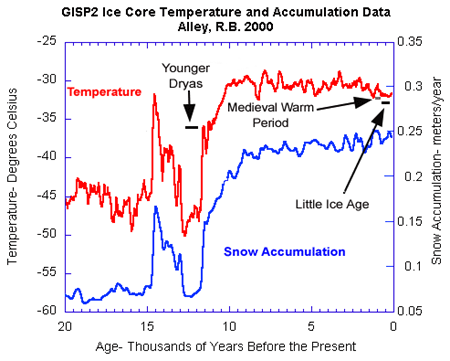
Graph depicting tempurature and snow accumulation change from Pleistocene -> MWP 1A -> Younger Dryas -> MWP 1B -> Holocene. Note how snow accumulation increases while temperature increases because water evaporates in warmer temperatures and causes precipitation. In very cold temperatures there is less evaporation and less snow accumulation.
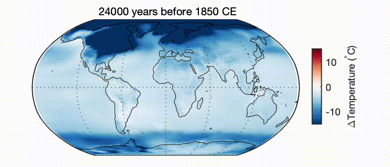
The above graphic pairs well with the visualization below depicting the change in temperature since the last glacial maximum on Earth. Notice how at the time of the younger dryas (around 13–12 kya), the temperature gets warmer, very quickly gets colder, and then gets warmer again.
As you can see, the ice sheets rapidly melt 16,000–10,000 years ago. Graphic by Matt Osman
Note: The Younger Dryas Impact Hypothesis deals with comet impacts causing the Meltwater Pulses and rapid cooling.
Some other cataclysmic events that could have caused MWP 1A and the Younger Dryas include a:
solar flare that scorches the earth and makes the surface uninhabitable,
meteor that causes mass destruction and sends Earth into a dark winter,
super volcano eruption that similarly causes destruction and darkness.
Note: The last two would cause a quick initial heating of the atmosphere and then nuclear winter type drop in temperature.
While the cause of the younger dryas is still inconclusive, the event itself was egregious.
A Genesis Sized Flood — MWP 1A and The Missoula Floods
As much as talking about the over 200 religions and myths that speak of a global flood occurring in ‘the beginning (of history)’, the basis of an argument for such a massive flood actually occurring must rely on high quality scientific evidence, and as such, this section of the article dives deep into the Missoula Floods and their impact on North America.
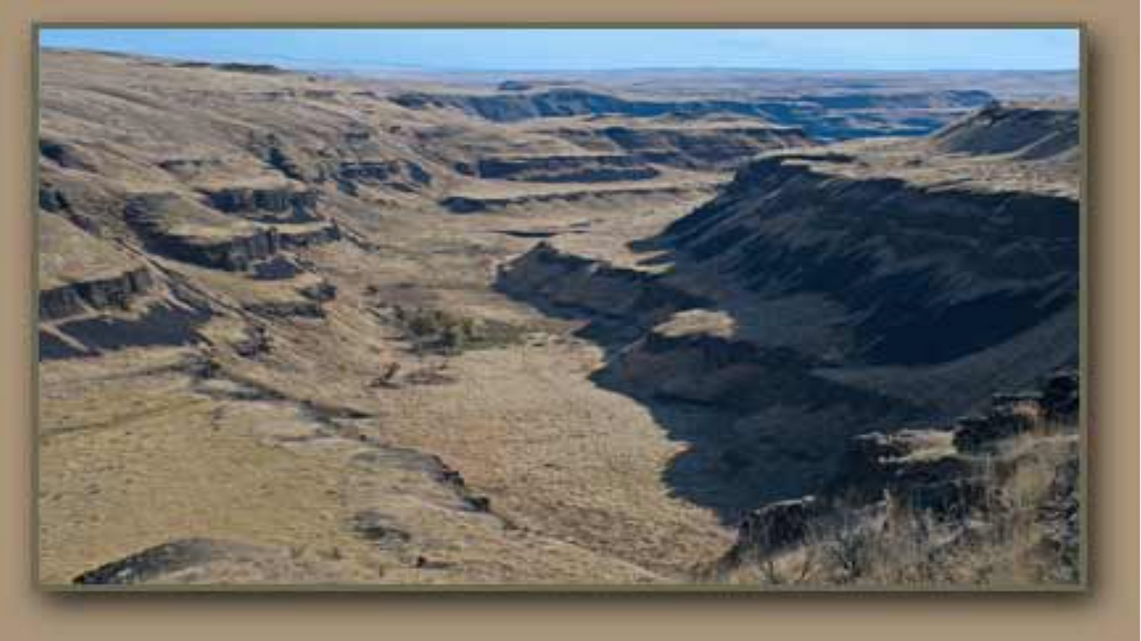
In his research on the “Missoula Floods,” Professor in the Department of Geology at the Colorado School of Mines, Keenan Lee, finds that Lake Missoula within the great North American ice sheet, began to debase the ice sheet and break free during MWP 1A (14.6 kya).
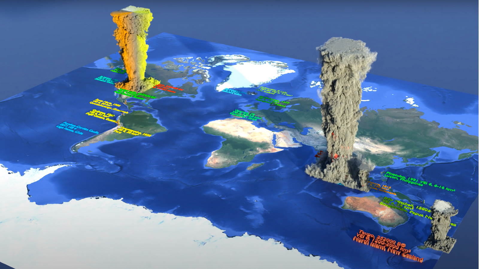
Glacial Lake Missoula Flood Path
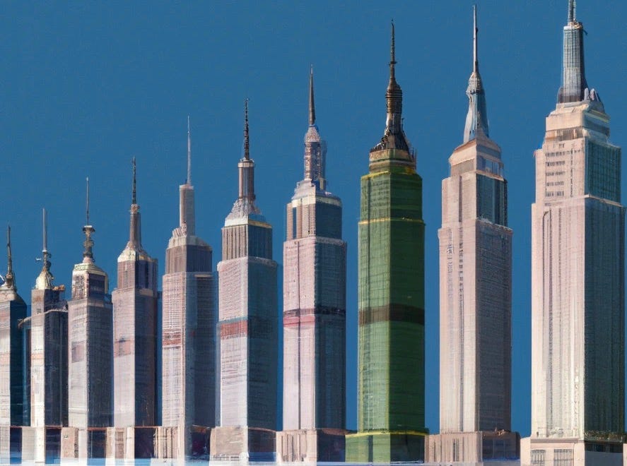
The lake was located on the western border of Montana and had a flood path in the pacific north-west releasing 386 million cubic feet per second, around 9.4 cubic miles per hour!
To provide a size reference, the empire state building is around 1200 feet tall and has a volume of 37 million feet cubed. This flood was like a wall of 10 empire state buildings being released from the lake per second!
DALL-E 2 — “exactly 10 empire state buildings lined up, digital art”
Lee’s research found there to be just over 500 cubic miles of water in Lake Missoula! That is roughly the volume of Lake Erie and Lake Ontario combined.
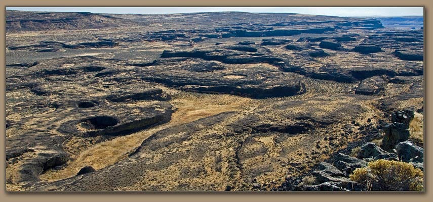
However, research published in Earth Science Reviewsshows that the Glacial Lake Missoula refilled and flooded many times, likely causing more than a hundred floods. The following is the excerpt from the paper on the Missoula and Bonneville Floods. (The full paper is worth a read, or at least a skim.)
Stratigraphic studies indicate dozens — likely more than a hundred — separate Missoula floods during the last glacial period.
Over the length of the flood route, backwater areas and depositional basins preserve multiple flood beds, many of which are separated by signs of time, including volcanic ash layers and soil development in subaerial environments; and varve-like beds and pelagic mud layers in lacustrine and marine settings.
Evidence also comes from the glacial Lake Missoula basin, where stratigraphy indicates dozens of filling and emptying cycles.
Varve counts in conjunction of radiocarbon dating and paleomagnetic secular variation show the repeated filling-and-release cycles of glacial Lake Missoula had intervals possibly as long as 100 years early in the lake’s history but diminished to just one or two years for the last few floods.
This behavior accords with jökulhlaup-style floods released by subglacial drainage from a self-dumping ice-dammed lake.
As any flood with the flow of 10 empire state buildings per second would, the Missoula Floods left lasting impacts on the land and the environment such as:
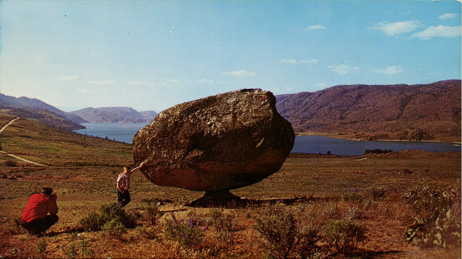
Boulders. Megalithic rocks deposited across the pacific north-west that provide us with evidence on the death and destruction that the Missoula Floods left in their path.
These boulders help us understand that the volume of water being released from the lake was large enough to not only tear up the Earth, but to move monstrous glaciers across the Earth, leaving a path of thoroughly ripped apart plant and wild life.
“Under what conditions did this great slaughter take place, in which millions upon millions of animals were torn limb from limb and mingled with uprooted trees?”-catastrophist Emmanuel Velikovsky in “Earth In Upheaval”
In the Alaskan mucklie the remains of the death and destruction of plant and wild life by flood. Velikovsky elegently describes how the muck provides evidence for volcanic eruptions, continental shifts, and massive waves in the following excerpt. (Feel free to only read the bolded parts.)
"I N ALASKA, to the north of Mount McKinley, the tallest mountain in North America, the Tanana River joins the Yukon. From the Tanana Valley and the valleys of its tributaries gold is mined out of gravel and “muck.” This muck is a frozen mass of animals and trees.
F. Rainey of the University of Alaska described the scene: * “Wide cuts, often several miles in length and sometimes as much as 140 feet in depth, are now being sluiced out along stream valleys tributary to the Tanana in the Fairbanks District. In order to reach gold-bearing gravel beds an overburden of frozen silt or ‘muck’ is removed with hydraulic giants. This ‘muck* contains enormous numbers of frozen bones of extinct animals such as the mammoth, mastodon, super-bison and horse.” ^
1 F. Rainey, “Archaeological Investigation in Central Alaska,” American Antiquity, V (1940), 305.
2 The horse became extinct In pre-Columbian America; the present horses in the Western Hemisphere are descendants of imported animals.
These animals perished in rather recent times; present estimates place their extinction at the end of the Ice Age or in early post-glacial times. The soil of Alaska covered their bodies together with those of animals of species still surviving.
Under what conditions did this great slaughter take place, in which millions upon millions of annuals were torn limb from limb and mingled with uprooted trees?
F. C. Hibben of the University of New Mexico writes: “Although the formation of the deposits of muck is not clear, there is ample evidence that at least portions of this material were deposited under catastrophic conditions. Mammal remains are for the most part dismembered and disarticulated, even though some fragments yet retain, in their frozen state, portions of ligaments, skin, hair, and flesh. Xwisted and torn trees are piled in splintered masses. . . . At least four considerable layers of volcanic ash may be traced in these deposits, although they are extremely warped and distorted. …”3
Could it be that a volcanic eruption killed the animal population of Alaska, the streams carrying down into the valleys the bodies of the slaughtered animals? A volcanic eruption would have charred the trees but would not have uprooted and splintered themj if it killed animals, it would not have dismembered them. The presence of volcanic ash indicates that a volcanic eruption did take place, and repeatedly, in four consecutive stages of the same epoch; but it is also apparent that the trees could have been uprooted and splintered only by hurricane or flood or a combination of both agencies. The animals could have been dismembered only by a stupendous wave that lifted and carried and smashed and tore and buried millions of bodies and millions of trees. Also, the area of the catastrophe was much greater than the action of a few volcanoes could have covered.
Muck deposits like those of the Tanana River Valley are found in the lower reaches of the Yukon in the western part of the peninsula, on the Koyukuk River that flows into the Yukon from the north, on the Kuskokwim River that empties its waters into Bering Sea, and at several places along the Arctic coast, and so “may be considered to extend in greater or lesser thickness over all unglaciated areas of the northern peninsula.” 4
3 F. C. Hibben, “Evidence of Early Man in Alaska,” American Antiquity, VIII (1943), 256.
What could have caused the Arctic Sea and the Pacific Ocean to irrupt and wash away forests with all their animal population and throw the entire mingled mass in great heaps scattered all over Alaska, the coast of which is longer than the Atlantic seaboard from Newfoundland to
Florida? Was it not a tectonic revolution in the earth’s crust, that also caused the volcanoes to erupt and to cover the peninsula with ashes?
In various levels of the muck, stone artifacts were found “frozen in situ at great depths and in apparent association” with the Ice Age fauna, which implies that “men were contemporary with extinct animals in Alaska.” * Worked flints, characteristically shaped, called Yuma points, were repeatedly found in the Alaskan muck, one hundred and more feet below the surface. One such spear point was found there between a lion’s jaw and a mammoth’s tusk.6 Similar weapons were used only a few generations ago by the Indians of the Athapascan tribe, who camped in the upper Tanana Valley.7 “It has also been suggested that even modern Eskimo points are remarkably Yuma-like,” 8 all of which indicates that the multitudes of torn animals and splintered forests date from a tune not many thousand years ago."
The mainstream hypothesis on the extinction of the megafauna is that the Clovis people in North America hunted them to extinction, which is possible, but less likely when you consider the massive cataclysms that occurred in North America and the massacre that ensued.
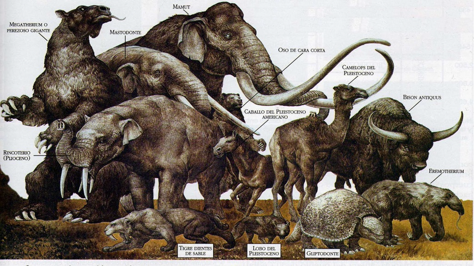
Randall Carlson, a cataclysmic geologist states that over half the megafauna on Earth were dead post-deluge with the following extinct; the Woolly mammoths, mastodons, saber-toothed cats, dire wolves, giant beavers, armadillos and camels, elephant-sized sloths, elk with 12-foot antler spans, giant bears that stood 6 feet tall at the shoulder, and woolly rhinos.
Some of the extinct Megafauna from the Pleistocene
So why should we care about some prehistoric flood?
We all know that the wooly mammoth went extinct when the ice age ended many millennia ago, but, what does it matter that it ended by apocalyptic flood?
Well, knowing how the last ice age ended can teach us about how we treat our human past. Consider the temperature of the Earth during the last ice age, about 10ºC colder. This means that the best places for humans to live were along the equator or close to it. Countries like Canada were uninhabitable, at least for larger groups of humans. (Check Matt Osman’s visualisation in the beginning of the article.)
So any possible early civilizations of humans in North America like the Clovis would have inhabited non-glacial areas of North America, such as the north-west flood path of the Missoula Floods…
If there was a or were civilization(s) in the North American flood path, they would have been utterly wiped out. And that is only the humans in the flood path; as already stated, over the course of 500 years, the sea levels increased by 18 meters worldwide.
So during supposed hunter-gatherer times, such as 15,000 years ago, pre-deluge, a much higher percentage of the population, most likely more than 90%, must have lived on the coasts of bodies of water, and any primitive civilization that could have existed, was most likely submerged.
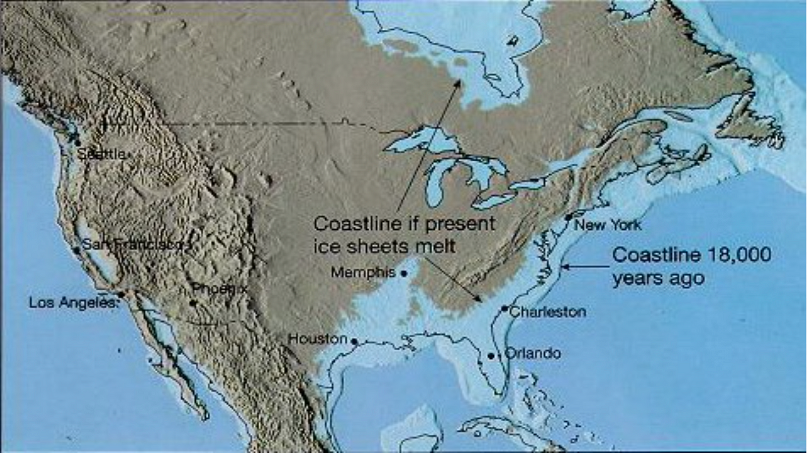
The light blue is an approximation of North America pre-deluge (glacial), the black outline is North America today (inter-glacial), and the brown is North America if the ice caps completely melt (post-glacial).
Since the sea levels increased worldwide, this point does not only hold for the North American coasts. This holds for coastlines worldwide, in fact, as there were most likely tsunamis due to these floods and more floods around the world during Meltwater Pulse 1A, coastal civilizations around the globe were most likely devoured by the flood.
This claim may lack ample evidence, but how could we know if these civilizations existed anyway?
Floods and tsunamis of this magnitude wouldn’t leave much evidence. But there are some mysterious underwater megalithic structures around the world like Yonaguni Jima off the coast of Japan and The Lost City of Dwarka in India.
Humans Past, Present, and Future
Consider that historians treat the beginning of ‘history’ to be the time period after the first written records. Based on this, historians believe history began in 3200 BCE when the middle eastern civilizations began to write records.
From the previous section, if any flooded or submerged civilization were even relatively advanced, they could have had written records placing the beginning of history back to before the end of the last ice age ( at least 14,000 ya).
Note: Another mass rejection of evidence among historians is the evidence of Water Erosion on The Great Sphinx of Giza (raised by Robert Schoch). A piece of hard to dispute evidence that would set back the existence of the Sphinx to before 12 kya — as opposed to the current lame estimate of 2500 BC — when the climate of the Sahara had enough rain to erode the Sphinx. This is a vast rabbit hole to research and essential to note on the topic of lost human knowledge.
Some more modern journalists, archeologists, and historians estimate the beginning of history to go at least as far back as 9500 BCE due to a archeological site named Göbekli Tepe, a megalithic city buried in 9500 BCE.
As opposed to the historians that wrote the current narrative of history, these modern historians are more optimistic on the idea of lost human knowledge due to cataclysms like the mythical biblical flood, and rightly so.
The following are the apocalyptic cataclysms that could end us:
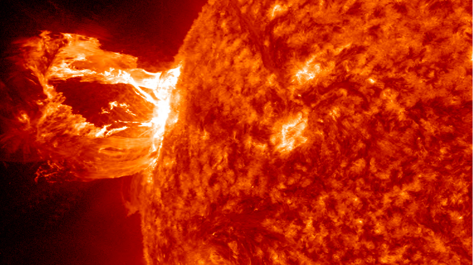
Solar Flare
Meteor Impact
The Tunguska Event was a meteor that flattened 80 million trees over 830 square miles of Siberia on June 1908.
"The generally agreed upon theory is that on the morning of June 30, 1908, a large space rock, about 120 feet across, entered the atmosphere of Siberia and then detonated in the sky." — NASA’s Near Earth Object Program
Tunguska Airburst — Siberia
Although the likelyhood of Earth getting hit by an asteroid may seem low, the last fairly large meteor strike was this Tunguska meteor of which had the blast of a 15 megaton nuke (1000 times Hiroshima bomb). The meteor most likely came from the Taurid Meteor Stream that passes by Earth in late June and early November. If we were to be hit by space rock, it would be then.
Super Volcano Eruption
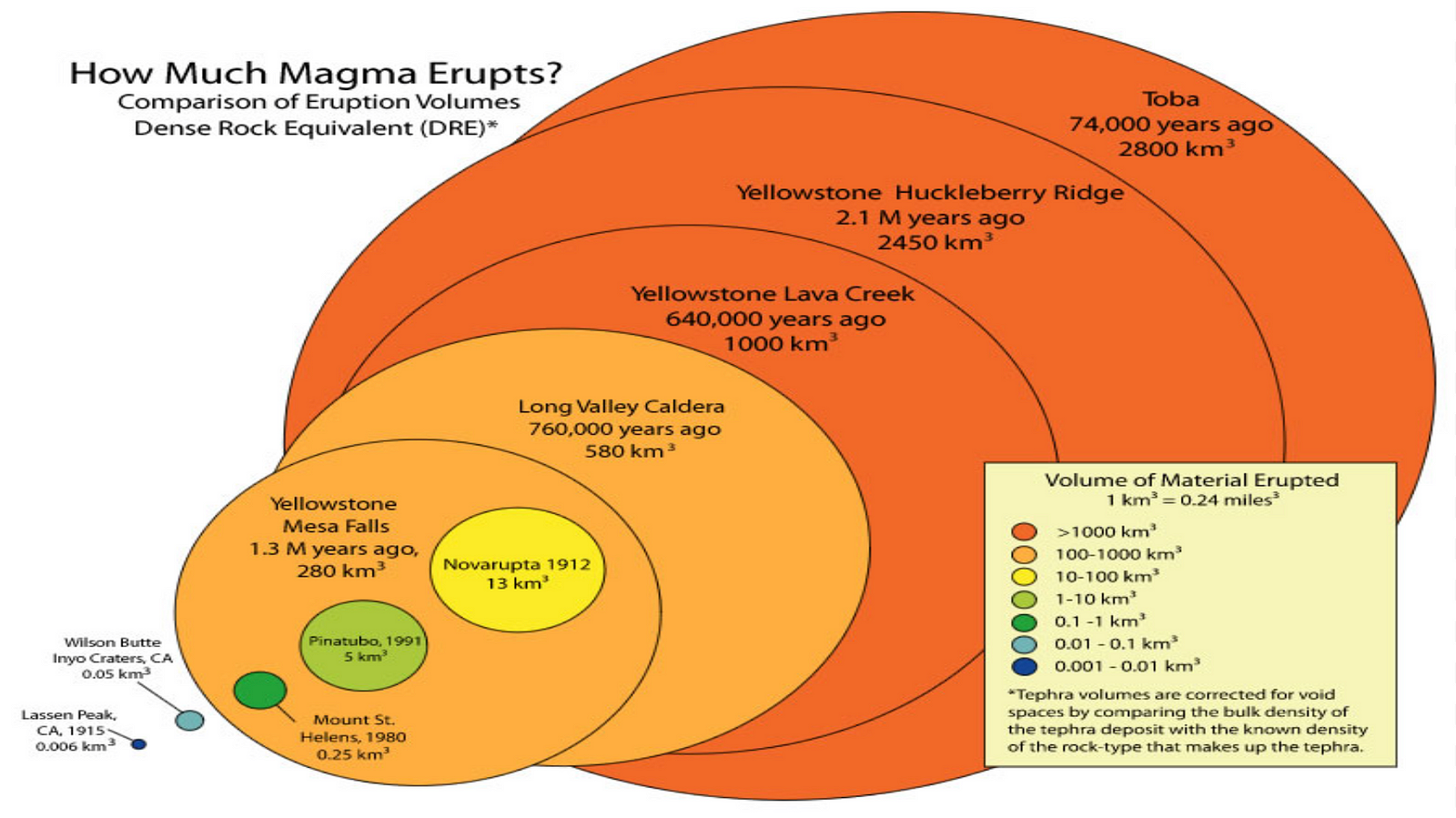
The chance of getting hit with a large meteor as opposed to a small meteor may be lower than the likelihood of end of the world by super volcano eruption. The below graphic depicts the largest Volcano Eruptions in the past 2 million years.
To the far left of the graphic, we see Yellowstone’s largest eruption 2.1 million years ago, and to the far right we see the larger Toba Eruption only 70,000 years ago!
Magnitudes of the volcano eruptions in the past 2 million years, Toba being the largest.
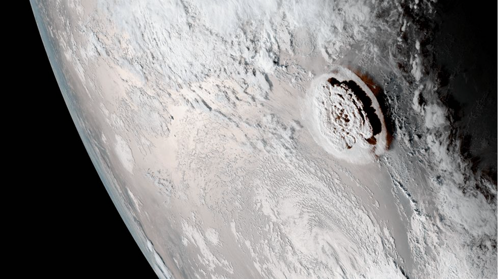
A more recent example of a large cataclysm, the Tonga Eruption in January 2022 was a VEI 5.7 volcano eruption causing an abnormally large amount of water to be evaporated into the stratosphere (suspected to increase global warming).
Tonga Eruption From Space
Even if all of these cataclysms are unlikely, we humans forget that there are unknown unknowns; as the late US Secretary of Defense Donald Rumsfelds said,
“There are known knowns, things we know that we know; and there are known unknowns, things that we know we don’t know. But there are also unknown unknowns, things we do not know we don’t know.”- Donald Rumsfeld
To save the human race and our knowledge, we must embrace (Hegel’s Premise of History) that our human past is not as linear as we believe; if we lost human knowledge in the past (by cataclysm), the same could happen to us.
Thank you for reading!
Gianangelo
Acknowledgements
I am quite passionate about this topic and would like to thank Graham Hancock and Randall Carlson for inspiring me to research topics of ancient history and unsolved mysteries. I would also like to thank John Horgan for guiding my journalism journey. Thank you 🙏🏼
Ryan Monaghan Professor John Horgan HST 401 Seminar in Science Writing 2 May 2025 Artificially Informed: How AI is Robbing Students of their Critical Thinking As a course assistant for a core Computer Science degree requirement, I saw homework scores that were higher than I have seen in the past—while I saw test scores that dropped to an all time low. What I saw wasn’t due to easy homework assignments and impossible exams, it was due to an ever increasing presence of AI in the education system. I’m not the only one who has seen this, however. Dr. Stephen Rupprecht, Assistant VP and Dean of Students at Kutztown University (and who did his dissertation on academic integrity) suggests that faculty should learn how to use tools to detect AI content effectively when enforcing and upholding academic integrity. He was also “not surprised by [my] experience of seeing high homework scores and low test scores” (Rupprecht). That being said, it isn’t all bad. AI promises huge productivity ...
Aidan Minnihan Professor John Horgan 5 May 2023 Social Media: RUINING OUR LIVES?!?!?! For better or for worse, the Internet has become an irreplaceable, inescapable part of our lives. We use it to stay in contact with friends and family; to apply for jobs; to work with coworkers remotely; the list goes on and on seemingly without end. Of course, none of this would be possible without the various social media platforms that exist. Social media has utterly revolutionized the way that we go about our daily lives, and it’s nearly impossible to thrive in our society without at least an email and LinkedIn profile. This necessary attachment to social media has certainly not come without many drawbacks, however, and our reliance on it has done much to contribute to the mental health crisis that we face today. First and foremost, it’s important to note that even separate from its necessity in everyday life, part of what makes social media such an omnipresent problem is that it is high...
Matthew P Kearney Scaling the Potential of Vertical Farming Going into 2025 and Beyond Vertical farming may seem like something out of a futuristic movie, but they are very real in today’s agricultural industry. Vertical farming may promote a stronger relationship between urbanization and sustainable crop production. Based on recent innovations across agriculture and technology, vertical farming has the potential to revolutionize our current farming system. Through the development of vertical farming-based production lines, cities and otherwise unfarmable areas can be provided with fresh, local, and pesticide-free produce. Vertical farming and other adaptations of agriculture are not new ideas, but instead a historic and human process. These technologies are ready to meaningfully address global food security through the technological and computational advancements in agriculture. Vertical farming has a promising future, which becomes a case...
Glacial Lake Missoula Flood Path


Comments
Post a Comment